The Hype
A fun and scenic technical canyon in Zion, far from the madding crowd. DED has a delightfully remote feel to it. Canyoneers will need to be proficient in natural anchor techniques. No permit required. Due to it being north facing and a long way up the North Fork road, this canyon is unlikely to be accessible in spring until all snow is melted and the road dried out.
Getting There
Getting There
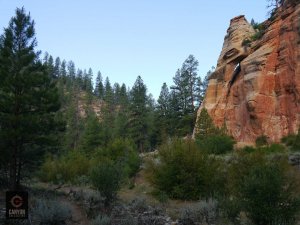
Deadeye Dick is descends north off Dakota Ridge into the North Fork of the Virgin River, just east of the Park boundary. While it can be done with one car, this would involve substantial elevation gain in rough terrain, and some unpleasant bushwhacking – not recommended. Spot a car for the exit at Chamberlain Ranch; start the adventure at the end of the Dakota Ridge Road. When dry, both roads can be driven by 2WD sedans. This tends to be regretted as the road is often heavily washboarded. HC 2WD or 4WD vehicles recommended. When wet, the road can be impassable to all vehicles.
Car Spot at Chamberlain
Chamberlain Ranch is the normal upper parking for The Narrows. Begin mileage where Highway 9 meets the North Fork Road. Head north on the NF Road 5.2 miles to the entrance to the Zion Ponderosa Ranch Resort. Reset your odometer here. Don’t turn into the Ponderosa – continue on the NF road, which soon turns to dirt. Drive 11.4 miles to the only bridge crossing a river (Total mileage from Highway 9 is 16.6 miles). Turn left at the T, then left again and continue ¼ mile to the Chamberlain Ranch main gate. Enter and close the gate. Continue down the road, then follow the posted instructions for parking; park vehicle #2 here.
Dakota Ridge Road
From Chamberlain Ranch, return south on the North Fork Road. Noting mileage from the bridge, drive 2.7 miles to a small road on the right (west) side of the road, past a large open field. The road is obscured by brush and can be hard to see. It is at the apex of a sharp turn back left. There is a small shack on the right (north) side about 50 feet from the North Fork road. This is the Dakota Ridge Road (DRR). Follow this rough road. At .1 miles it forks – go left. At .5 miles, several washes cut the road, and some vehicles will need to park here. 1.2 miles from the North Fork Road the DRR splits. Park here.
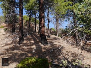
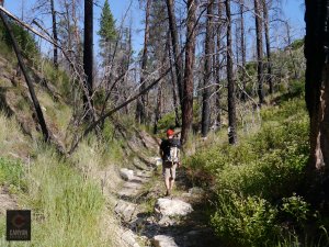
Hiking
From the carpark, hike the right hand fork. It soon crosses a substantial washout. Hike the track 0.9 miles, about 25 minutes, to where it turns sharply left into upper Walker Gulch. Leave the track and continue west on a use trail along the ridgeline. In 0.4 miles, about 20 minutes, the trail turns southwest toward a prominent higher ridge. After a steep climb to the crest of the ridge, Deadeye Dick is the drainage on the other side. The best way to get down is to follow the ridge north (right), then diagonal north down the slope where it looks best to descend to the bottom of the drainage.
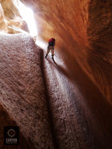
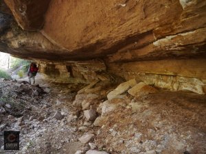
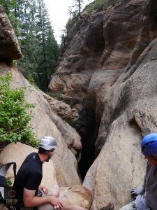
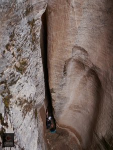
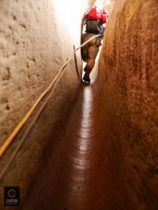
The Canyon
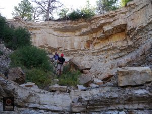
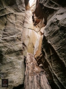
Click for original size Hike down the canyon. In about 30 minutes, the first dryfall is encountered, easily bypassed on the right. The canyon soon cuts down into the Navajo sandstone and becomes more intense. A short drop can be bypassed to the left, leading to the junction with a large tributary from the west. The first of several rappels is found soon after. Rappel and downclimb through the lovely fluted slots and colorful slickrock.
The final rappel is the longest at 100 feet, and features an eye-popping view of a large wall across the canyon. Deadeye Dick turns sharply left for the last two hundred yards of moderate downclimbing and walking to its junction with the North Fork.
The Exit
Follow the North Fork upstream (east). Use trails abound on both sides, often too many. Eventually, a ranch road appears on the south side of the river, and is followed back to the waiting vehicle at Chamberlain Ranch.
Red Tape
Deadeye Dick is on BLM land in Kane County. 24 hour Emergency phone number: 877-644-2349 ext 1