This isn’t what I’d consider a “great” canyon, or even a “good” canyon, … in fact it’s not really a “canyon” at all, but a fault crack (thus the name). Friends and I did this one back in 2007 and recently people have been going through it so I’m assuming that there’s some interest in it. For those that are, here’s the info.
Note – I didn’t take extensive notes at the time, so feel free to post corrections as needed.
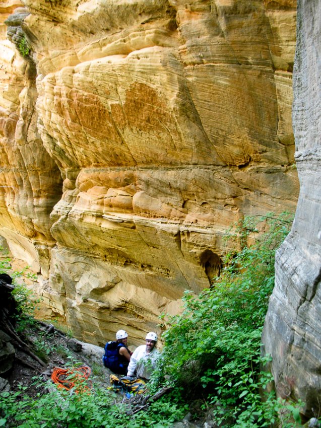
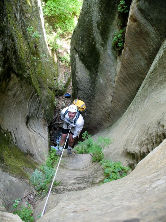
OVERVIEW: More of a fault crack than a canyon formed by flowing water, Crack Addict is a tributary of Sterling Canyon. The canyon was totally dry when I was here, but there might be a puddle to wade.
LOCATION: Coconino National Forest
REQUIRED GEAR: 2×150′ ropes, 60’ webbing, 10 rap rings, harness, descender, helmet, and carabiners.
ACA Rating: 3A III
Distance: 2.7 miles
Physical Difficulty: Strenuous
Elevation: 7,000 – 6,080 ft.
Time Needed: 5-8 hours
Best Time of Year: Fall, Spring
Vehicle: High Clearance
Car Shuttle: No
Maps: USGS Dutton Hill AZ 7.5
Navigation: Moderate
DRIVING DIRECTIONS: From Highway 89A north of Oak Creek turn west on FR 535. Drive 5 miles on this dirt road to a sign pointing left for Harding Point. Turn left on FR 535A, then left again a short distance later (towards Harding Point). Park between the canyon entry and exit near UTM: 12S 430645mE, 3875591mN, WGS84 Datum.
TRIP DESCRIPTION:
Drop into the drainage near UTM: 12S 431119mE, 3875191mN, WGS84 Datum.
Thrash through the brush.
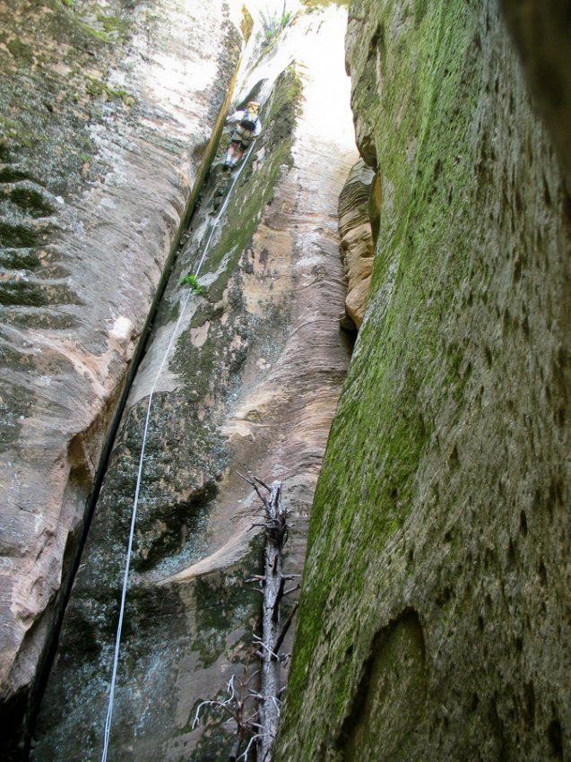
Rappel #1: 70 feet from a tree on the right.
Rappel #2: 50 feet from a tree on a bench on the left.
Rappel #3: 20 feet from a pinch point in the middle of the canyon.
Rappel #4: 70 feet from a tree on the right.
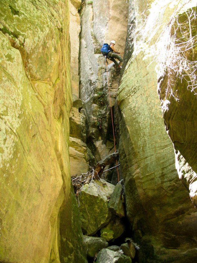
Rappel #5: 25 feet from a pinch point on the right at the top of the drop.
Rappel #6: 120 feet from a tree on the left.
Rappel #7: 25 feet from a pinch point in the middle of the canyon.
Rappel #8: 45 feet from a big tree at the top.
Complete a tricky downclimb or rappel
Rappel #9: 25 feet from a pinch point at the top of the drop.
Rappel #10: 140 foot double drop from a tree at the top.
Continue downcanyon to the junction with Sterling Canyon, then turn left and head up this drainage. It’s a steep, brushy climb that is largely unpleasant. Eventually, progress will be blocked by a vertical cliff. Work your way around to the left and climb the loose dirt slope to gain the top. From there, continue to thrash the remainder of the way up and out of Sterling to the rim, then walk cross country to the south back to the road and your vehicle.
Ram
Thank you Todd. Always found it odd that folks advocate for the “Freedom of Information Canyoneering Act” and yet never say THANK YOU when someone shares something new. Again, thank you Todd.