“Ribbon Canyon”
This trip started with a simple Facebook post. @Scott Patterson had posted in the Colorado canyoning group, and after a few back and forths and some checking with spouses and schedules, we set down a plan to do a little winter canyoning. The goal for the day was a small canyon we had both looked at on the map a couple of times, a shallow but narrow looking canyon that drops out of Little Park, wanders through some slickrock, and eventually becomes Echo Canyon by the southern entrance to Colorado National Monument.
Scott dropping in at the southern Ribbon TH
Up there somewhere are a handful of shallow slots and narrows
Scott and I met in GJ around 8:30 at his house, and after a remarkably quick drive, we were hiking by 9. A quick jaunt down The Ribbon trail had us in the canyon bottom. Following a smaller tributary up, we quickly gained a ridge which we followed for a long time. When we finally dropped off the side of this, we were at the very bottom of the canyon we wanted to explore. There are actually a couple of canyons in this complex that are intriguing, and they both come together right where the trail comes down.
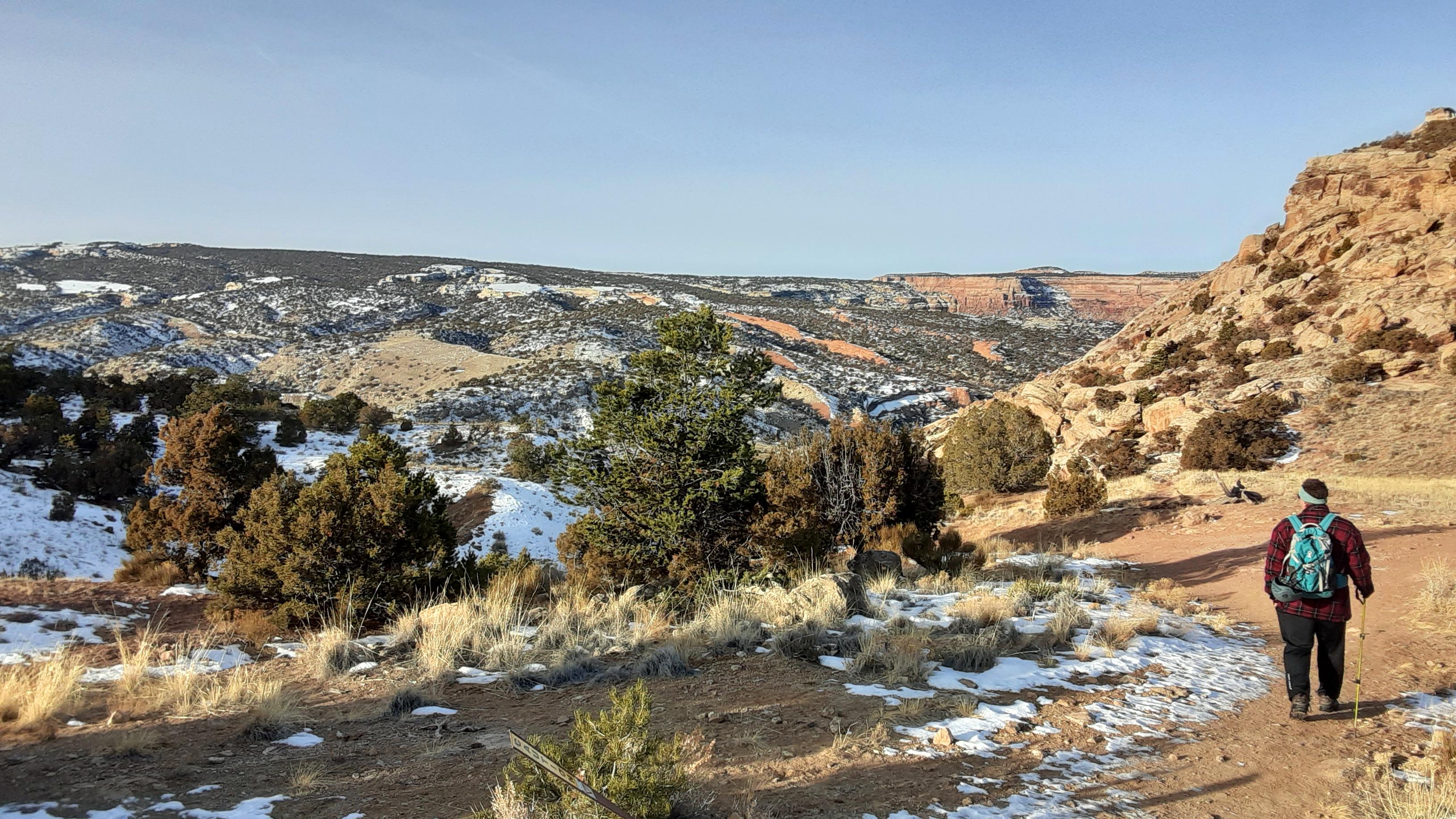
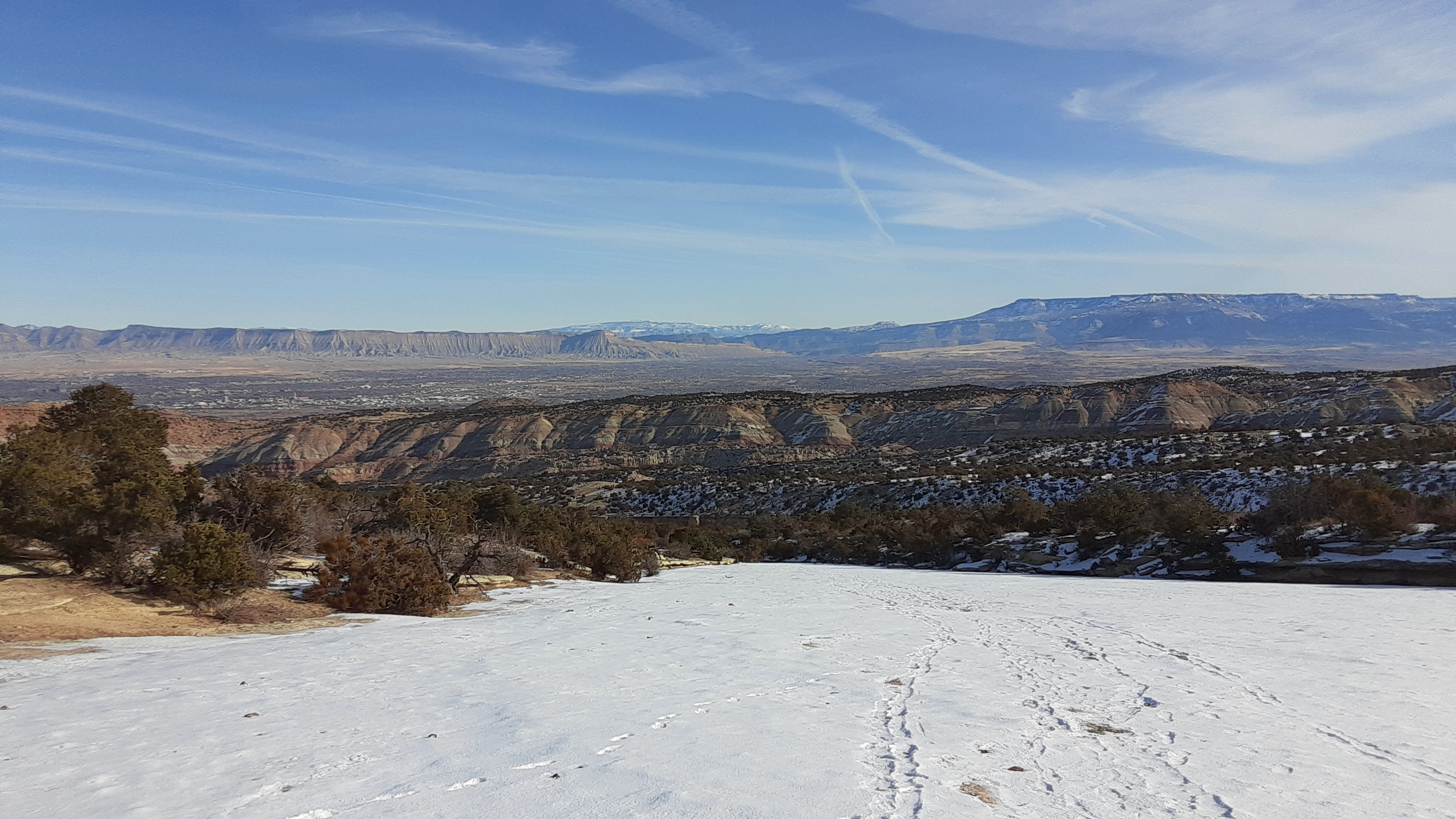
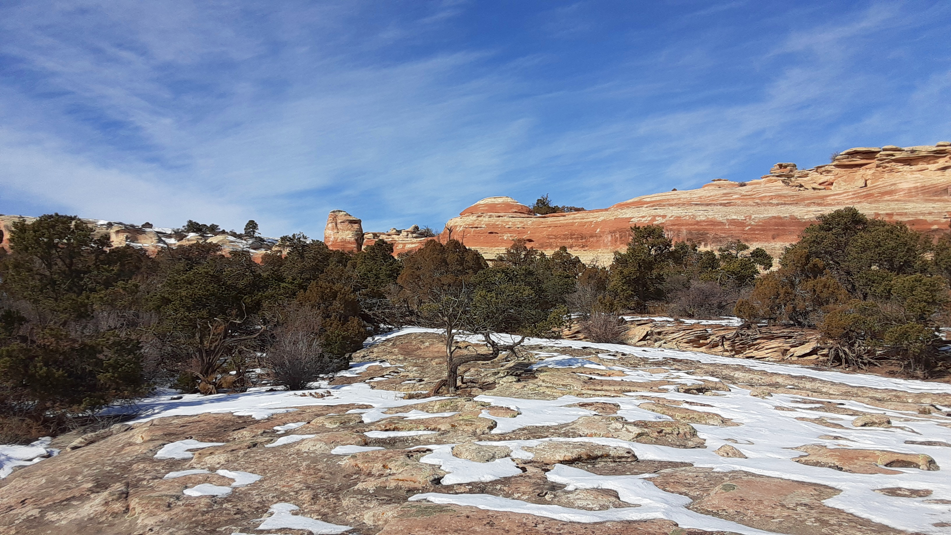
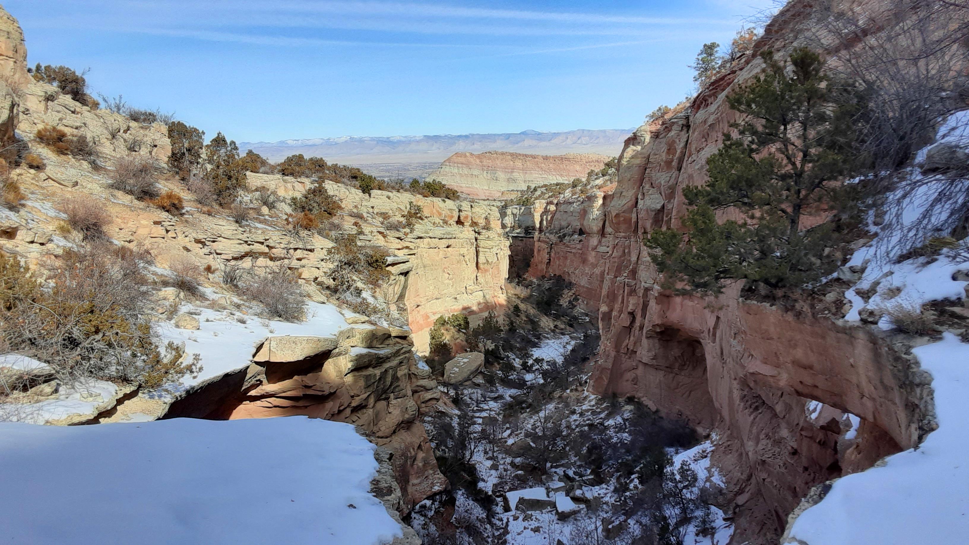
Views of the Grand Valley
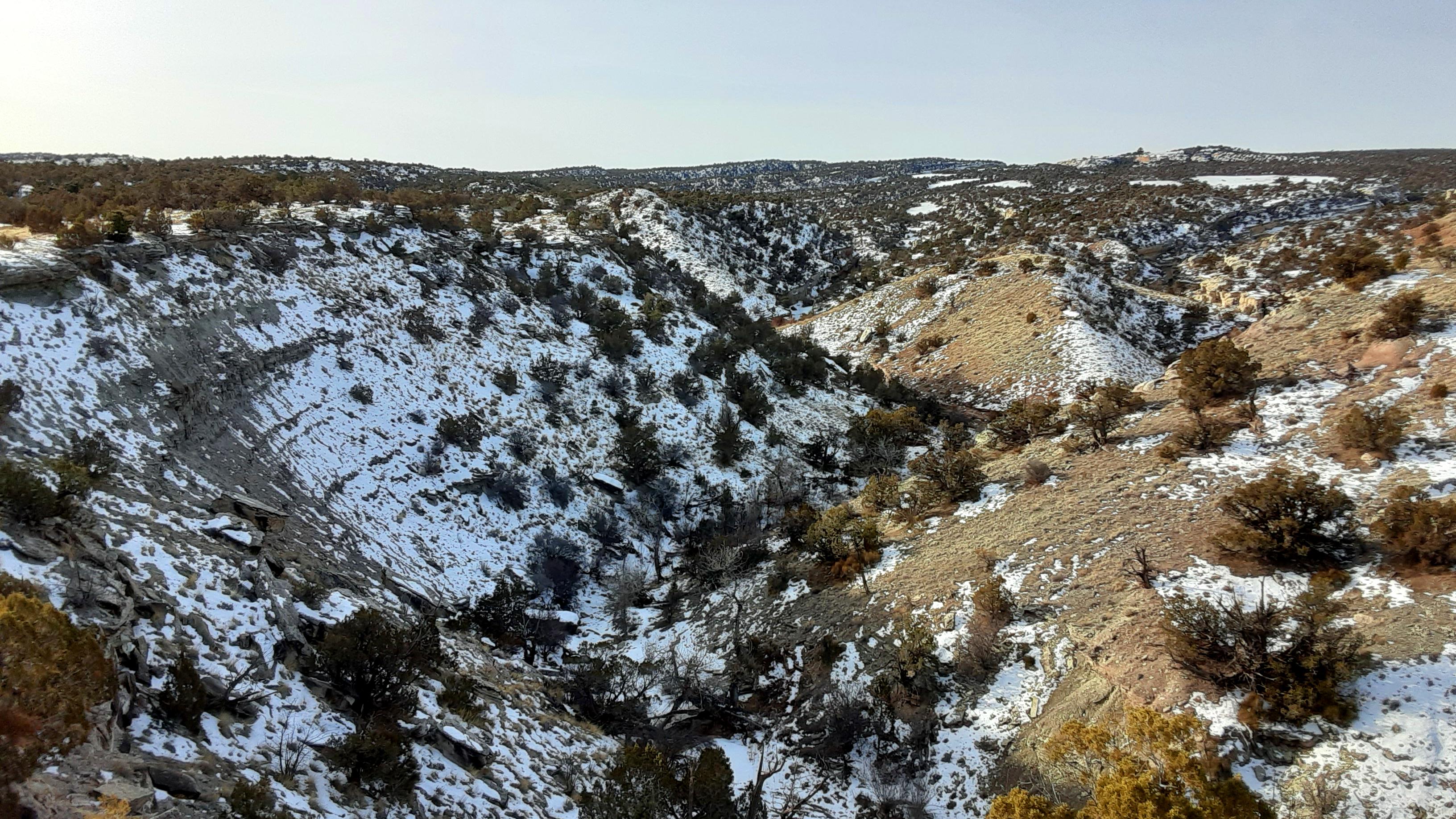
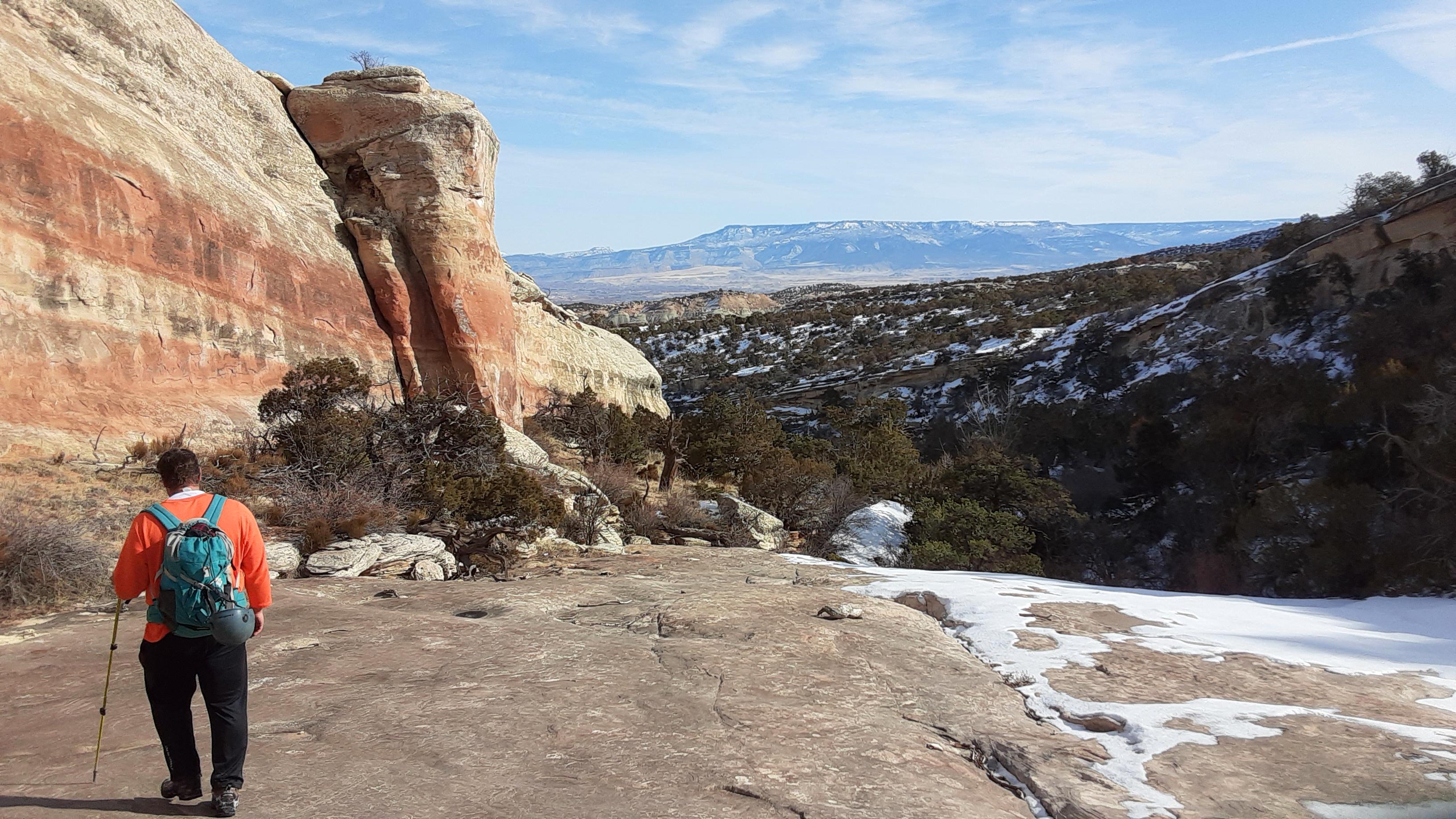
From here, we climbed out of our target canyon, and started climbing the slope of the monocline beside the canyon. After a while we ended up on an interesting slab of slickrock that climbed steadily for a long ways. The views behind us of the Grand Valley unfolded dramatically. After perhaps an hour of uphill, and some scrambling down and back out of a couple smaller side canyons, we found ourselves overlooking the main canyon itself. A five minute scramble had us in the bottom.
Entrada at the top of the canyon
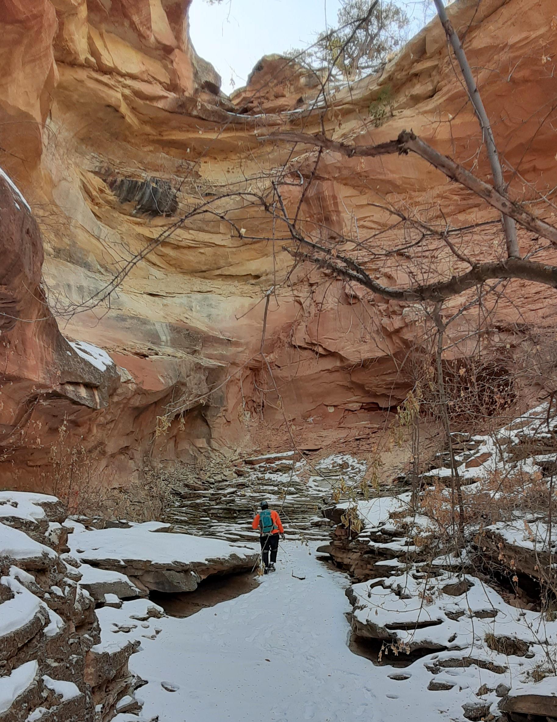
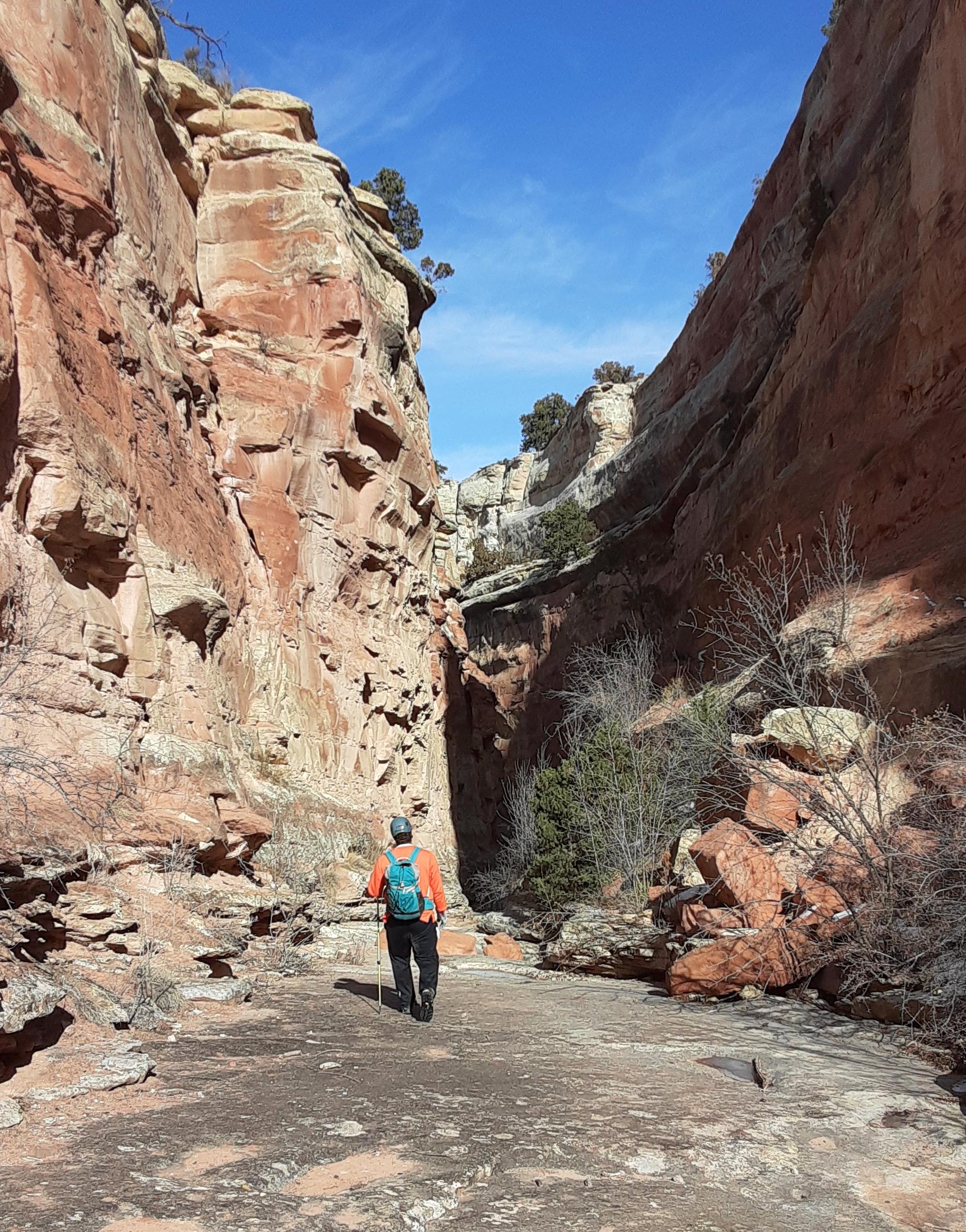
The first part of the canyon was wide and open, bounded by beautiful walls of Entrada between 40 and 60 feet high on either side. We made decent progress here, encountering our only real bushwhacking of the whole route. Several easy downclimbs were made before the walls narrowed and the first rappel came into view.
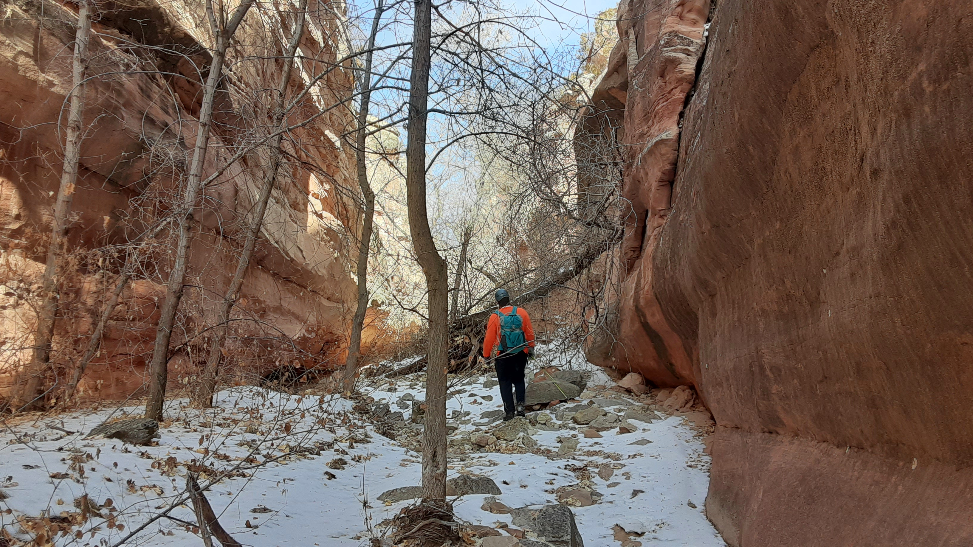
Heading down “Ribbon Canyon”
Scott as it starts to drop and narrow
A small drop typical of the pre-rappel section
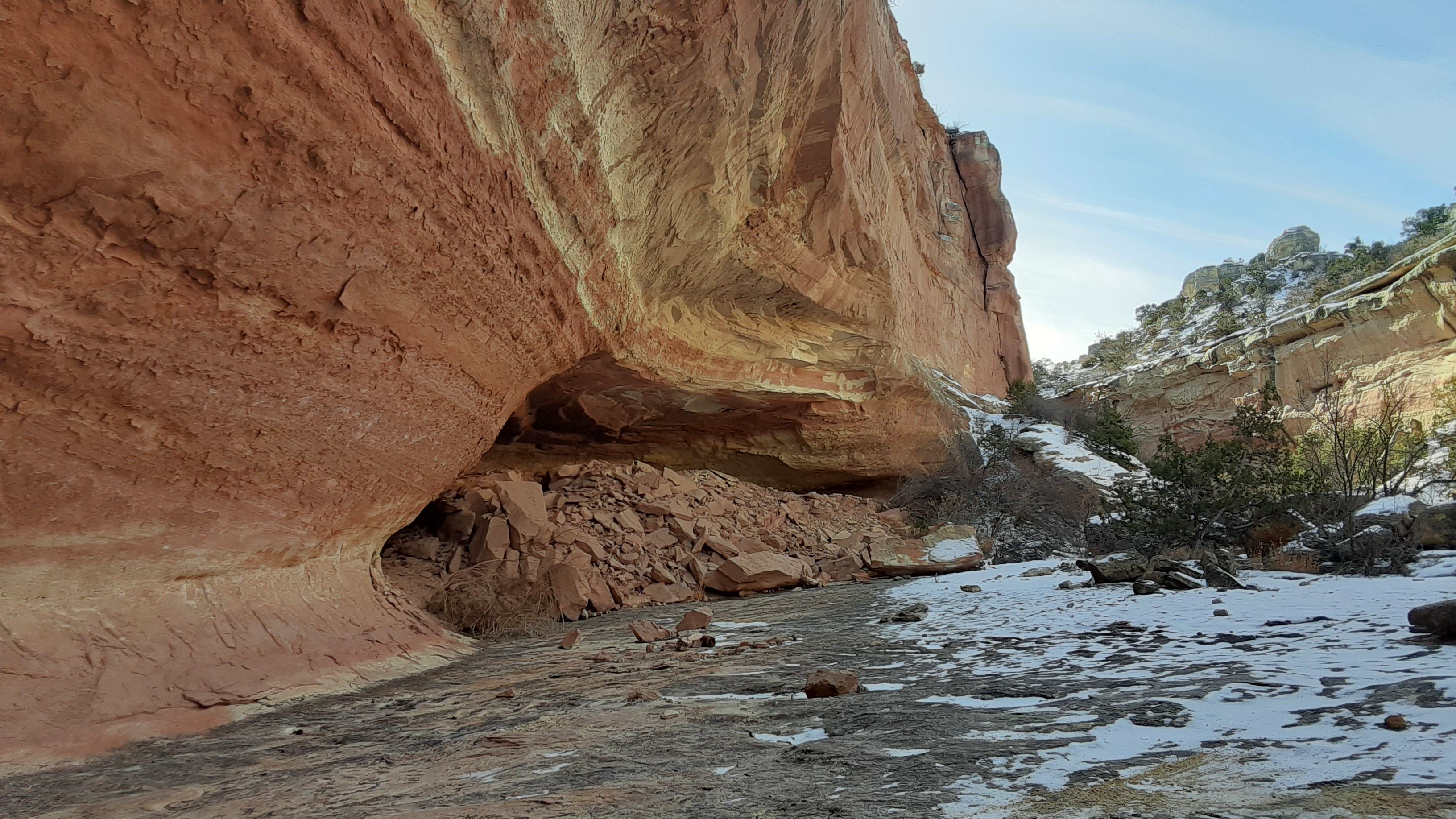
This drop, which would end up being our only rappel, had a few different options. The drop itself was a rounded, slightly overhung alcove about 60 to 70 feet in height. There is a tree just above the lip on the right, or you can traverse left about 50 feet and use a small tree that enables a good starting position. We opted for the latter, and although we did have to rappel down through some minor tree branches, it was pretty inconsequential and we were down in no time. Unfortunately, I didn’t get any pictures of Scott on rappel.
At the top of the dryfall. We rapped from a small tree in center left of this photo, down the left canyon wall
At the bottom, looking at the dryfall. We rapped out of frame right
One more down the dryfall
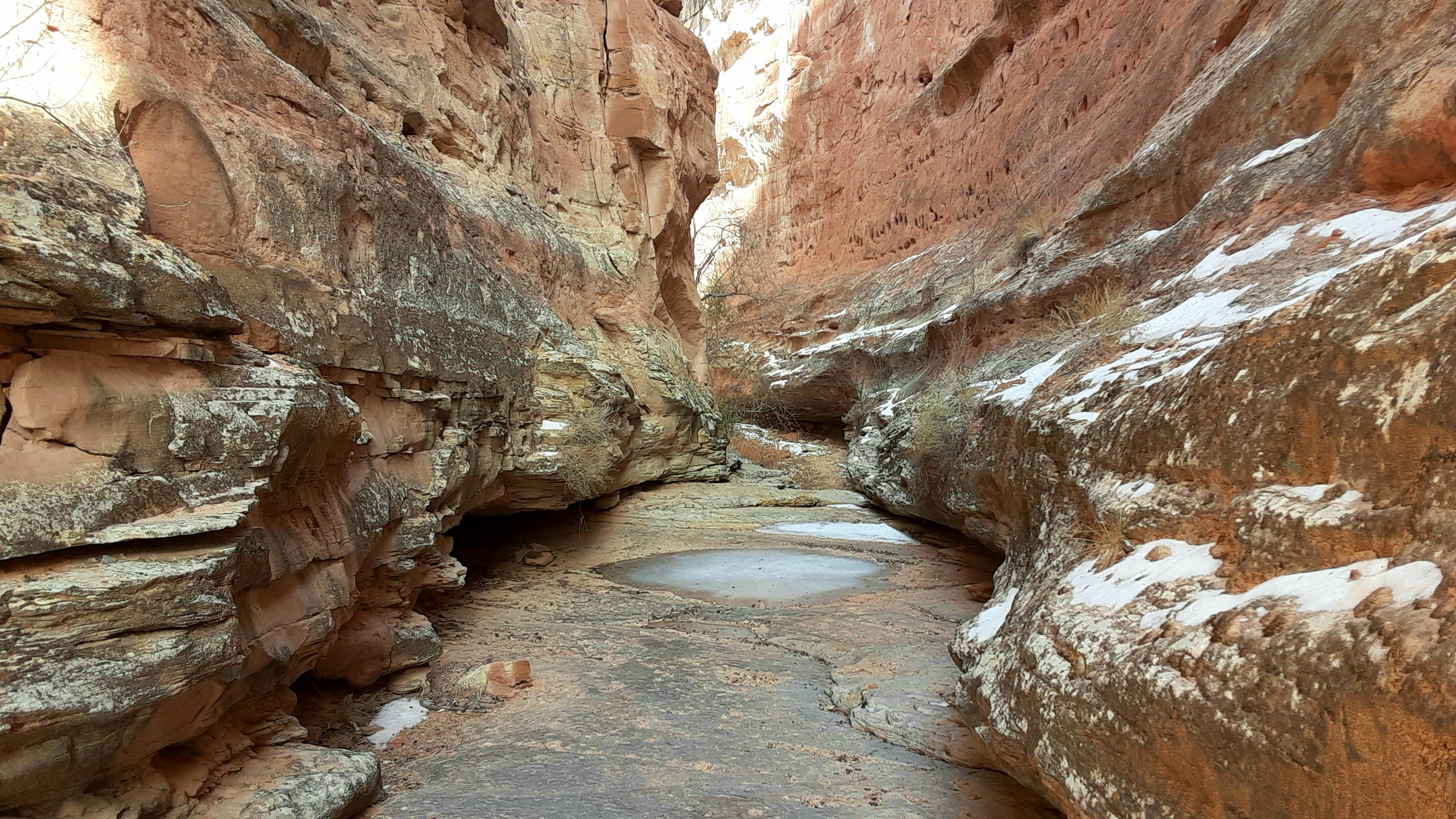
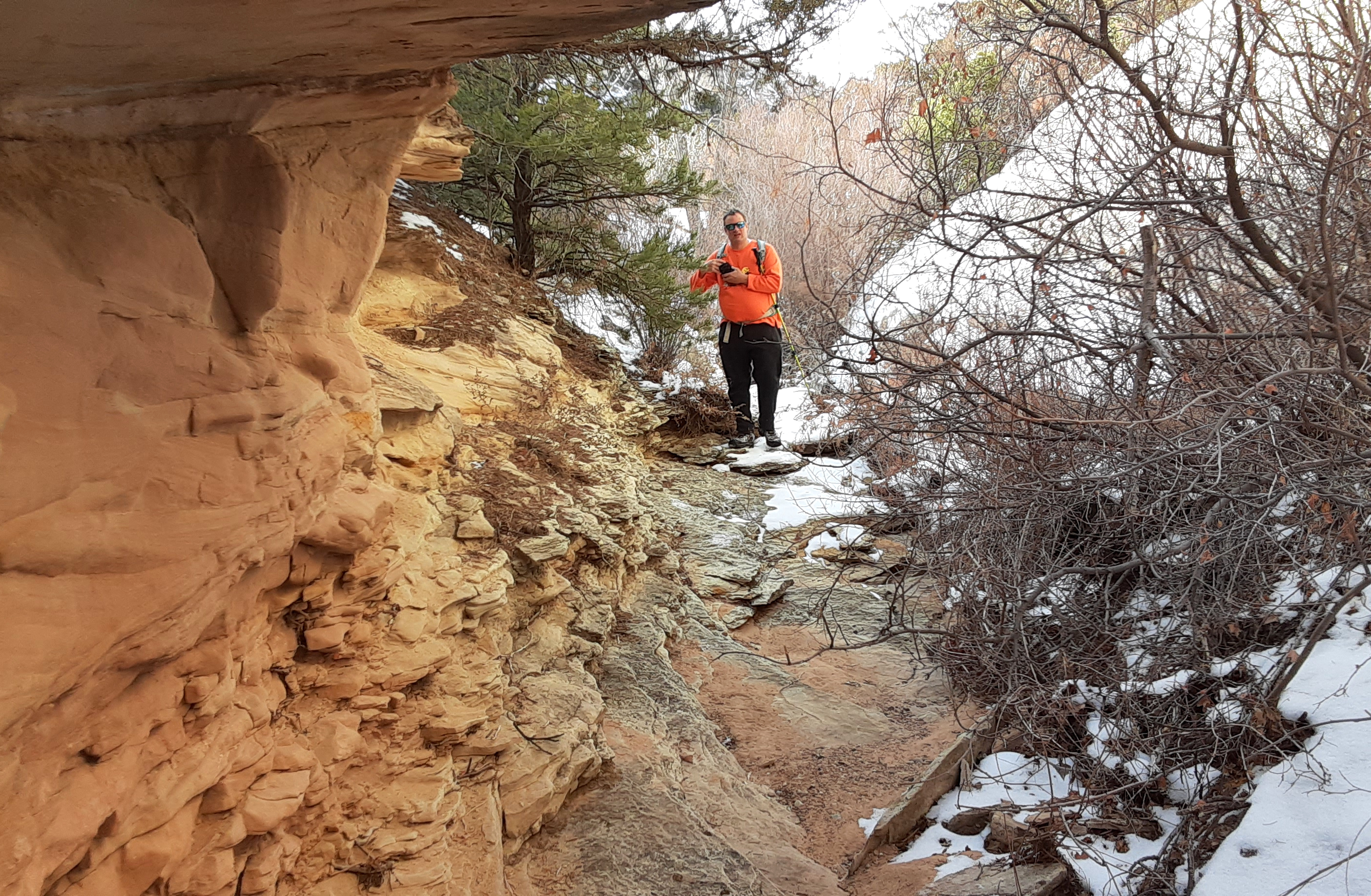
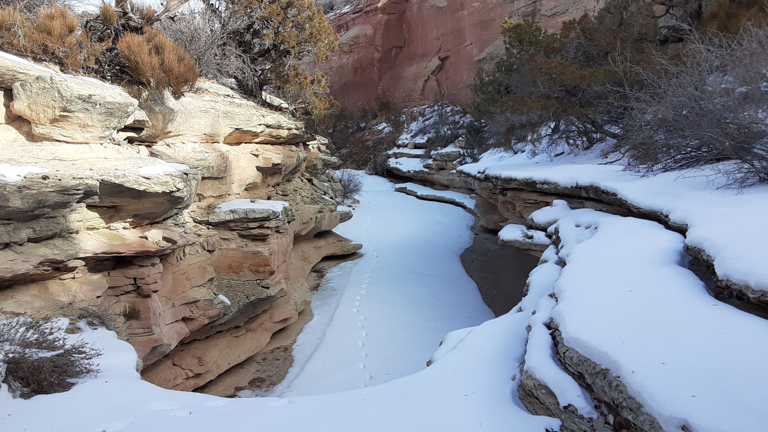
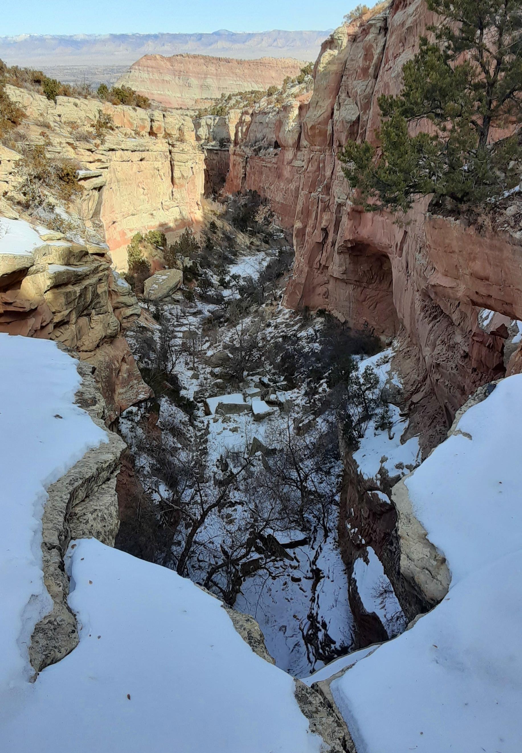
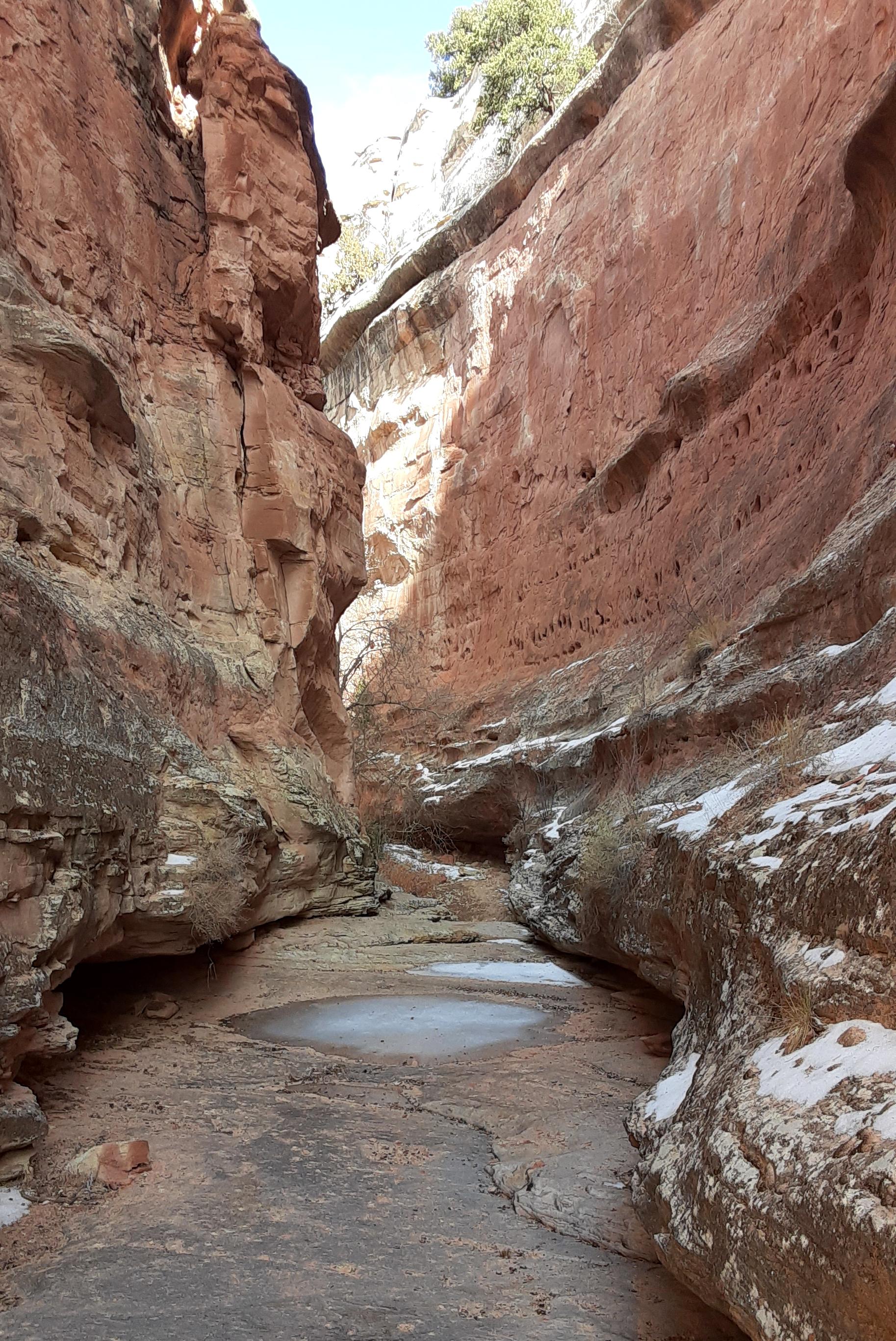
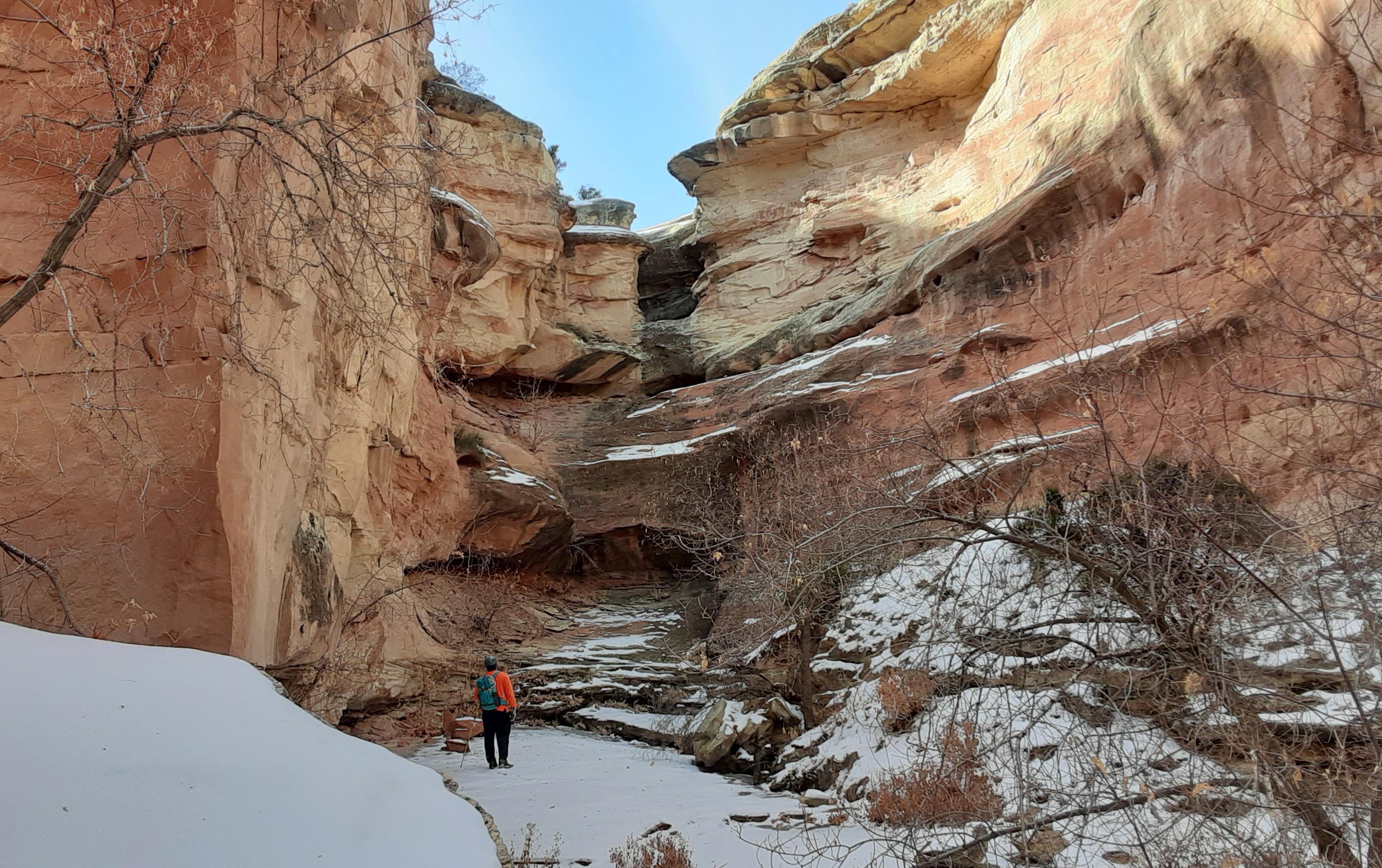
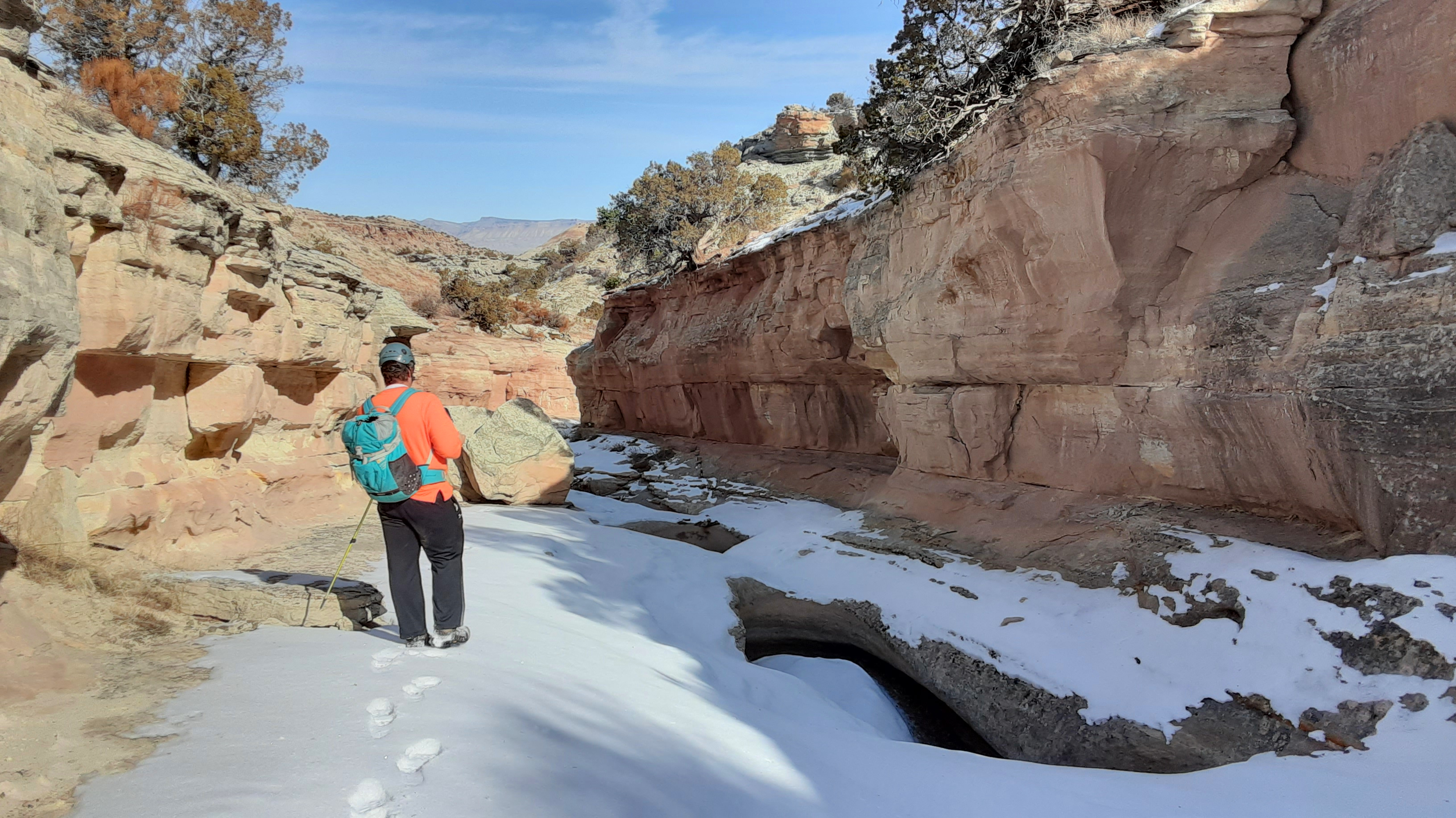
After coiling the rope, we headed downstream. The canyon was fairly deep, maybe 80 to 100 feet most of the ways, but was also fairly flat bottomed and dropped without serious loss of elevation. We passed a couple of nice alcoves on the right canyon wall, and the canyon began narrowing into the tightest spot. Although it cannot be called a “slot”, as it is just about as wide as my arms held out, it is still a pretty, if short, narrows. Below this narrows, one of the side canyons that we passed on the hike up joins the main canyon. There is a neat alcove under this drop.
Alcove larger than it appears in photo
Headed into the tightest part
The tightest spot, looking downcanyon
Same, looking upcanyon
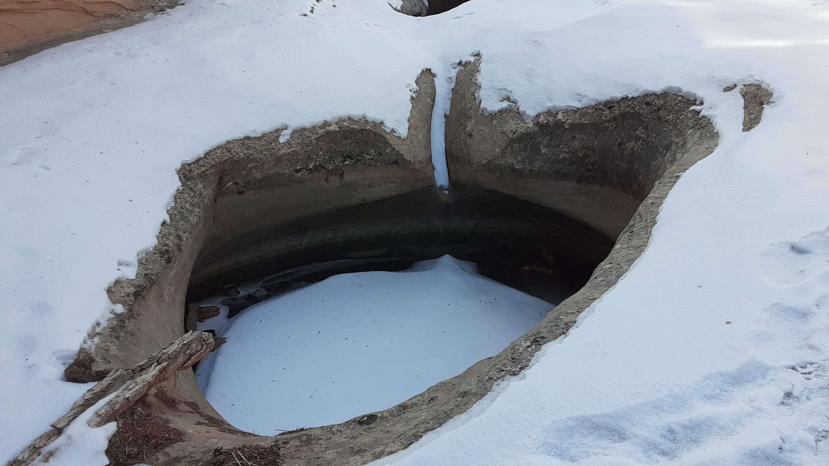
Side canyon alcove
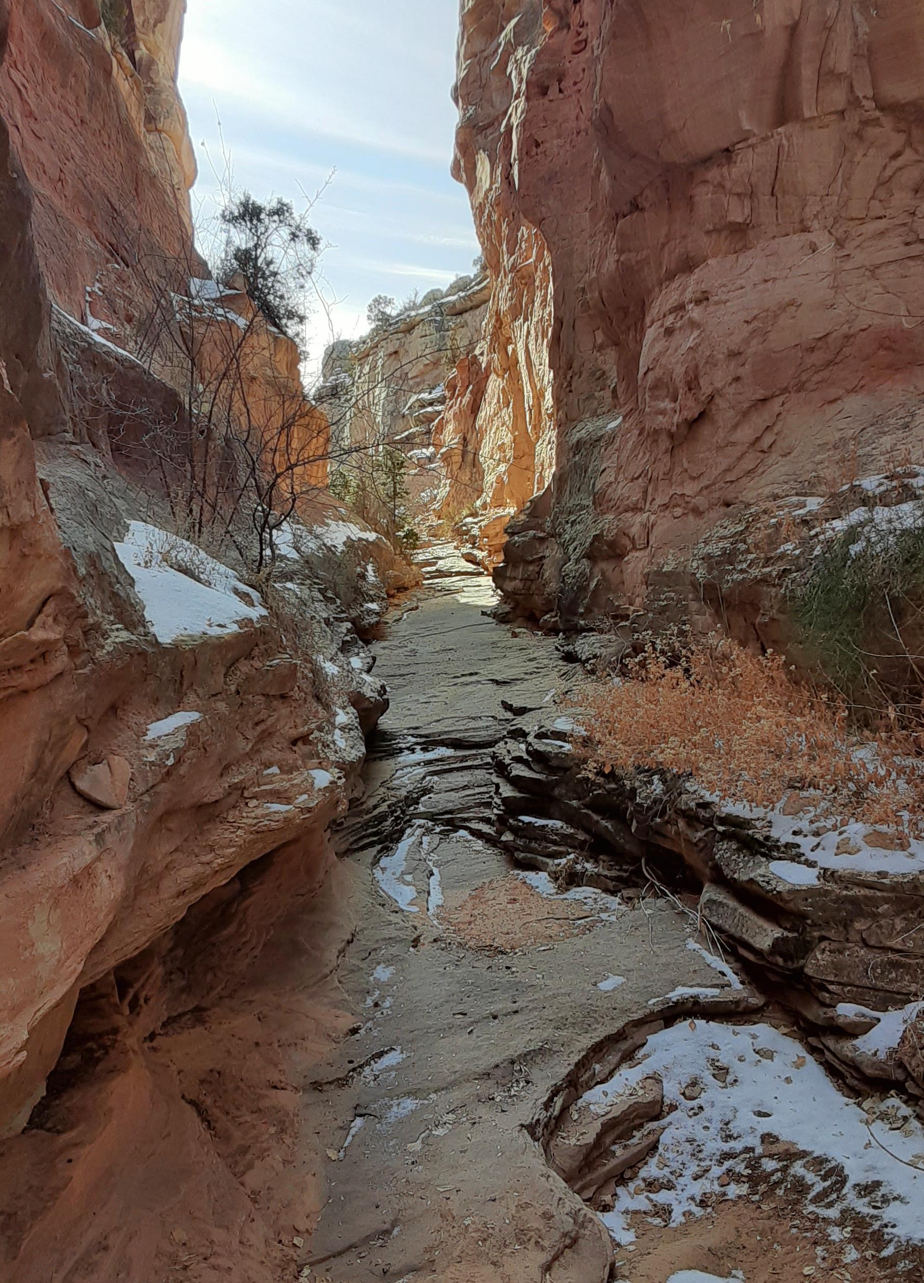
The canyon stayed vertical as we proceeded down, but the narrows soon gave way to a more wide bottom. After a couple of neat flat slabs of slickrock on the bottom, we soon got to the pothole section. Here, a chain of about seven or eight interestingly shaped potholes line the bottom of the canyon. Most of these are shallow, and there are wide sidewalks on either side so they are definitely not mandatory. They are interestingly shaped, however, and in the spring or after a late summer rainstorm these might actually make some nice bathtubs to cool off in. A couple of them look like they could be keeper status, if they were deep enough, with overhung rims.
Headed down
Pothole corridor
Pothole in the snow
Below the pothole section, the canyon opened briefly, meeting the Ribbon Trail, and then dropped into one more small mini-slot for about 100 yards. Never more than about 15 feet deep, this mini-slot is fun to follow, although committing to it means committing to following the drainage, and not the trail, back down to the exit. But this is not difficult and only takes perhaps 20 to 30 minutes. From here it was just 20 minutes up the hill (and through the tunnel) back to our car.
On the way to the exit trail
And finished for the day
The canyon itself isn’t the greatest, but the ability to do a car to car shuttle here makes this another simple canyon for the Grand Junction area. But, one reason I would come back is……..
Optional Combo Route: If you have set up a vehicle shuttle with one at the upper Ribbon TH and one at the Echo Canyon TH at the East Entrance to CoNatMon, you could very easily do the single rappel that divides this upper “Ribbon Canyon” complex and the lower Echo Canyon area, and then walk out Echo to your car. Doing this route would give you at least two raps of 70+ feet, and around 2,000’ of elevation loss. I suspect it wont be long until Scott does this combo and reports back.
Looking down into Echo Canyon
John Styrnol
Just in the Little Park (Bangs) area alone, I’ve done some drainages/canyons, they have the makings of being some great little canyons if they only had the right development/rock. The shape is there, but way too many trees, dirt. Still nice area to explore. Awesome for mountain biking though.
ratagonia
Thanks Scott.
yetigonecrazy1
Further north, towards Dinosaur & Vernal, you start seeing Weber and Nugget sandstone, which is akin to Navajo, but that section is generally missing in the Grand Junction area.
Scott Patterson
Yes and I believe Weber in and around Dinosaur is related to the Cedar Mesa.
The Navajo seems to disappear just east of Dewey Bridge and thus is missing in Grand Junction.
SW Colorado does have Navajo especially in places such as Slickrock and Ponderosa Canyons of the Delores. Also, there is a lot of Navajo around Mc Elmo Creek and its side canyons. It isn’t as thick as the Navajo around Lake Powell or Zion National Park though.
yetigonecrazy1
No Navajo. Or, what very little there is is minor, crumbly, and inconsequential. Most of the classic Monument is in what’s left of the Glen Canyon Group- the Entrada, Kayenta and Wingate. Most of the massive cliffs and monuments that people are familiar with are in the Wingate.
Kuenn
Great report. Nicely documented. Thanks for taking the time to share it and for the comparative geology lesson!
yetigonecrazy1
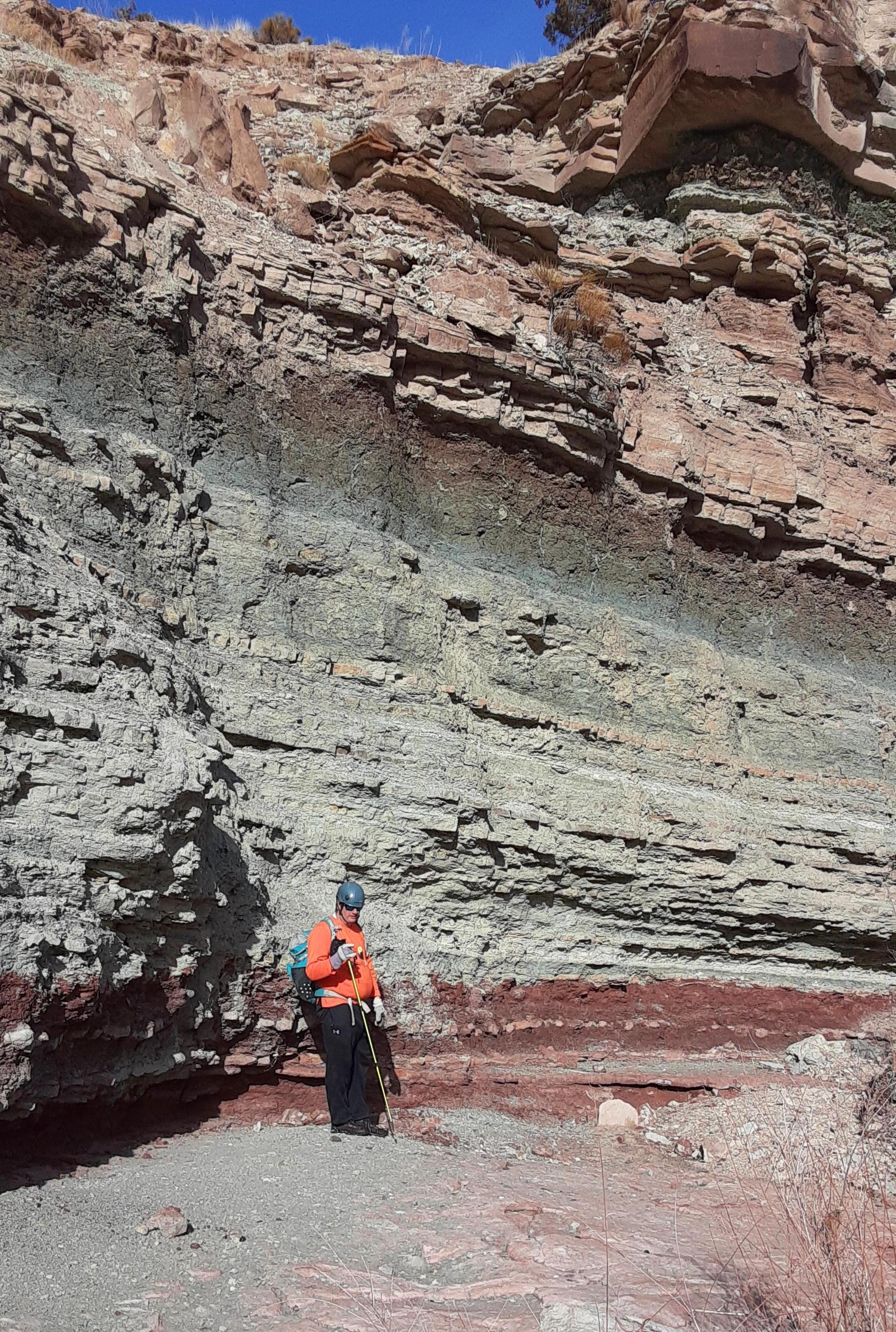
I found this strat column on a Google search, good visual map of those layers!
source
ratagonia
As that great geologist Tip O’Neil once said: “All Strat Columns are local”.
Is this the strat column for an area close to Ribbon Canyon?
Tom
yetigonecrazy1
As the canyon is about a mile south of the southeast border of CoNatMon, and is made up the same geologic landform, I Googled “Colorado National Monument stratigraphic column”. I found some that were a little more scientific and thorough, but they were all black and white and kind of hard to see. I chose the one above as it was nice and in color and easy to read, and basically gets 99% of the local geo correct.
ratagonia
No Navajo there? What layer are the classic ‘monuments’ in?
Tom
Scott Patterson
They are all Wingate, capped by Kayenta.
The Navajo isn’t the only rock layer that is missing in that area though. Below the Chinle (and sometimes the Wingate), the rock layers are related to the ones in the deepest parts of the Grand Canyon and are around 1.7 billion years old. The Chinle is about 200 million years old, so there are about 1.5 billion years of missing layers between the two formations.
Interestingly, the area around Grand Junction has both some of the youngest sedementary rock layers (in the Book Cliffs and Roan Cliffs) on the Colorado Plateau and the oldest (the Precambrian Basement rocks), but a lot of the middle rocks are missing.
yetigonecrazy1
That is pretty cool. Not a lot of miles as the crow flies from each other, either.
Dan H
That is the strat column for all of the canyons on the west side of Grand Junction, where this canyon is located.
Scott Patterson
It was fun to get out with yetigonecrazy.
It was a beautiful canyon, but the narrows are fairly short (but pretty). I’d hit it up again (especially when combining it with Echo Canyon), especially since it is only a few minutes from my house.
Anyway, just in case anyone is interested as to why there are a lot of canyons around Grand Junction, but very few slots, this might be of interest.
The reason that real slots are in short supply in Grand Junction is because the Navajo sandstone is missing. The geology south of Grand Junction usually goes to to bottom, Morrison, Entrada, Kayenta, Wingate, Chinle (sometimes) and the precambrian granite type and metemorphic rocks. Sometimes there is Dakota and Mancos above that. Usually and in Utah the Navajo is above the Kayenta, but it’s completely missing here. (North and East of Grand Junction and in the Book Cliffs and Debeque Canyon areas are younger rocks and different layers, but that’s another story).
The Entrada forms slots both in Utah and Colorado, but they tend to be very short. South of Grand Junction, Shaylee’s Birthday Canyon is a real slot, but it is short. In Utah the Entrada slots tend to be short as well. Death Canyon in North Wash and parts of Twilight Canyon, as well as the slots around Cannonville are all Entrada slots, but they are all short.
In Utah the Kayenta does form slots, but only in a few areas (at least that I know of). These areas are in Zion National Park (such as Subway and the Right Fork) and the San Rafael Swell (such as in Devils Canyon, Eagle Canyon, Crack Canyon, and Ramp Canyon), but since the hard cliff forning Kayenta layers are always shallow, the slots are never very long.
This particular canyon featured in the post above is in the Kayenta.
In Utah, the Wingate forms slots, but only in certain areas. In most of Utah the Wingate does not form slots. In places like the east side of the Escalante it does. Such canyons include the South Fork of Choprock, Neon, and Ringtail Canyons. The North Wash slots below and downroad from Hog Springs are also Wingate (Morocco, Merry Piglet, Marinus, etc.). Capitol Reef has a few Wingate slots (Pandoras Box and parts of Burro Wash), and there are some Wingate narrows NE of Moab and in the Ticaboo/Little Rockies areas, but outside those areas they are rare.
I don’t think any long slots exist around Grand Junction for these reasons. There are a lot of nice canyons that are beautiful, but any slots there are going to be very short.